
AREA MAPS, SUBDIVISION PLATS &PLANS
Here you'll find various maps, TMR's subdivision plat, and engineering plans. The file names are self descriptive.
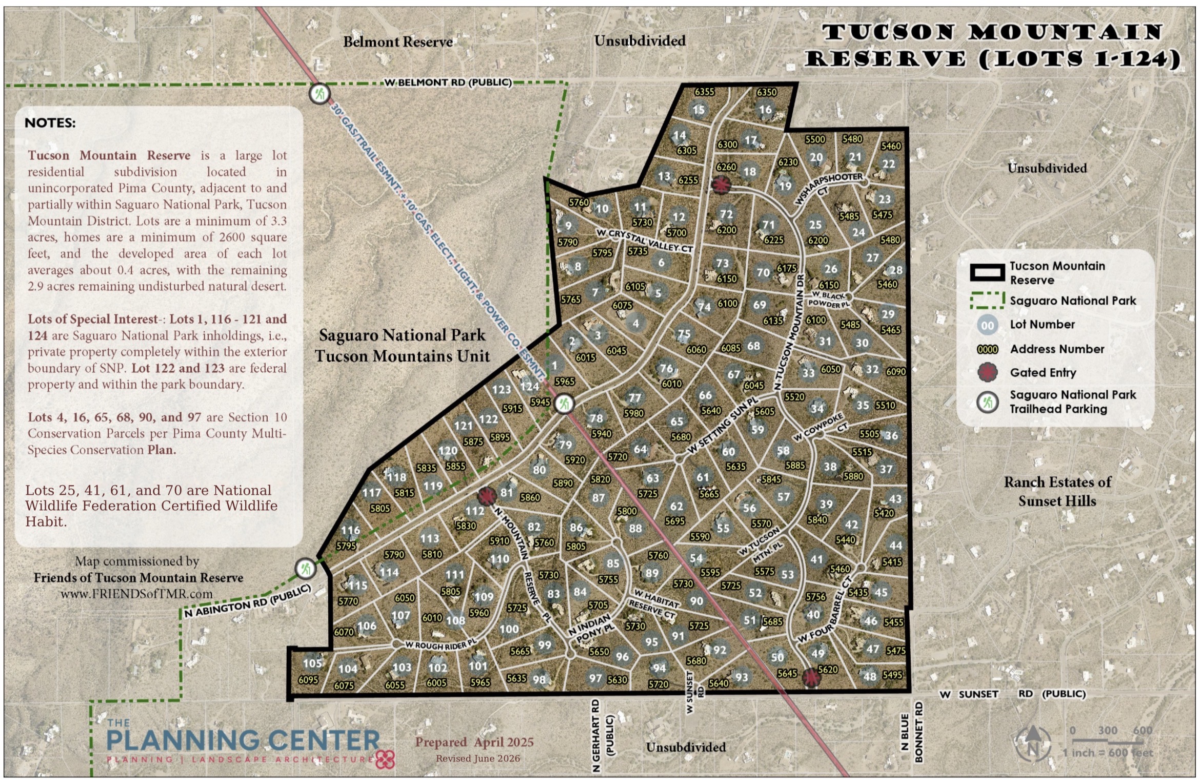
The TMR map contains valuable information. It is sized at 11" x 17" for printing purposes. Be sure to adjust your printer settings if you want a different size.
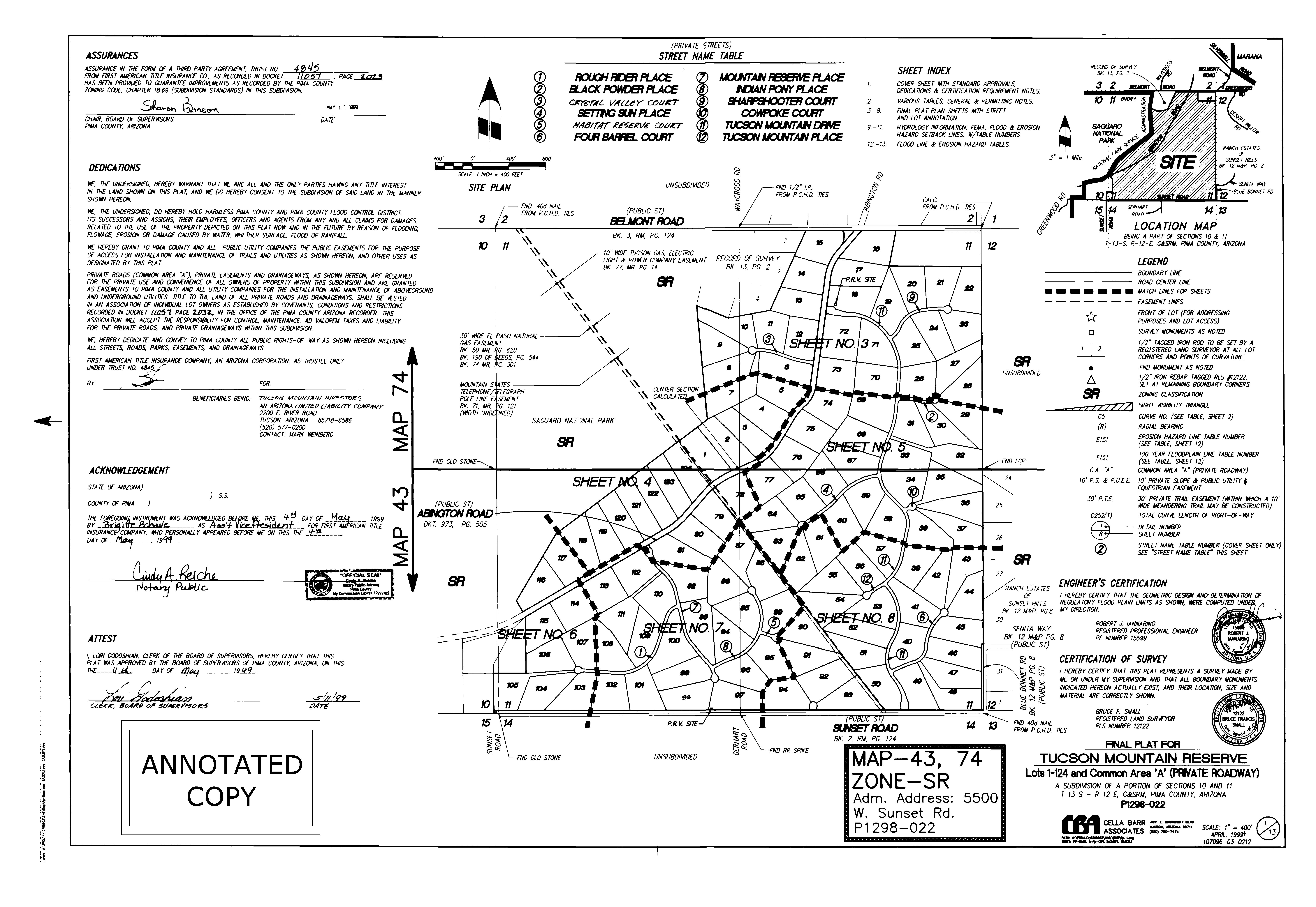
The subdivision plat is a boring-looking document to most people, but it is by far one of the most important resources on this website. The plat creates the individual lots and gives the parcels a simplified legal description (such as Lot 41) versus a lengthy metes-and-bounds description. The plat establishes a wide variety of easements with purposes ranging from intersection sight visibility, vehicular access restrictions, and location of utility corridors. TMRHOA, Inc is responsible for maintaining all of the Common Areas and extensive slope and drainage easement identified on the plat.
The diagonal line running NW-SE through TMR is a 40-ft wide combined gas and electric easement. It is the utility companies' responsibility to maintain, although the underlying land is private property owned by the adjacent TMR lot owners. This easement also contains a public hiking trail, dedicated to Pima County for non-motorized use only. Although much of TMR has restricted public vehicular access (i.e. it's gated), non-motorized access to the public trail is not restricted. Pima County plans for the trail to eventually extend from Avra Valley to Downtown Tucson. A separate article about this easement will be posted soon.
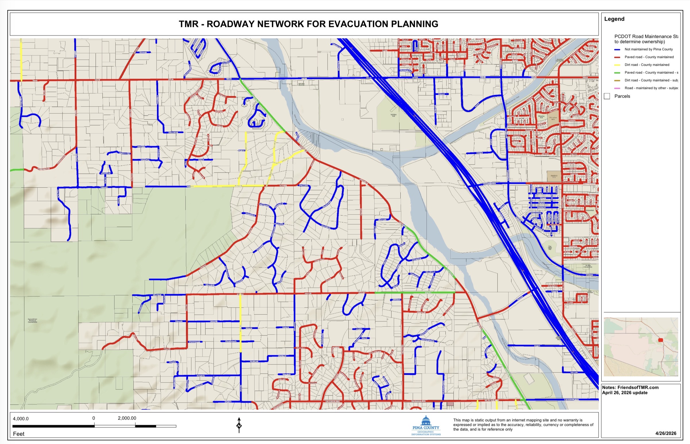
The roadway network map is worth spending some time studying because you'll be able to identify evacuation routes from your home in the event of flooding, grass fires/ember storms, earthquake, or other natural disaster known to occur in the region. Flooded drainage crossings during the monsoon season pose our biggest and most common challenges. The Tucson Mountains CDP has an incomplete roadway network, mostly due to extensive and poorly-planned "wildcat development" that does not provide all-weather access. This limits the number of viable alternate routes.
All documents posted on the FRIENDS website should be considered unofficial. For official documents, check with the County Recorder or your TMRHOA, Inc. management company.
| File | Uploaded | |
|---|---|---|
Pages
- Home
- FRIENDS of TMR Official Map
- FRIENDS NEWS and UPDATES
- 🚜SILVERBELL ROAD: ECDC TO INA👷
- THE MONITOR REPORTER (HOA Specific)
- Members Only
- DOCUMENTS TOO IMPORTANT TO IGNORE
- ALL ABOUT HOMEOWNERS ASSOCIATIONS -
- Contact FRIENDS Here
- AREA MAPS, SUBDIVISION PLATS &PLANS
- FRIENDS Surveys and Survey Results
- Photo Gallery
- Calendar